Saturday, 3 September 2005
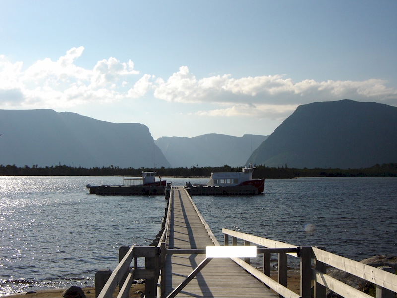
We were up early on the Saturday morning as none of us could sleep, and we wanted to leave lots of time to get to the boat that would take us in to the trail. We had our usual breakfast and then drove our van to the parking lot at the end of the Long Range Traverse. We took a taxi 30 minutes up the highway to the trailhead before hiking the three kilometers of well groomed trail that brought us in to the launch point for the tour boats that travel Western Brook Pond. We quickly changed into shorts as the temperature was well above 20° Celsius and probably got near 30° by mid day with the humidex.
Our initial plan had been to take the boat into the drop point and then camp overnight at the primitive campsite near the dock. We would then be able to begin the long ascent of the gorge at the Eastern end of Western Brook Pond gorge with plenty of daylight ahead of us. Once the day arrived, we changed our minds since we were able to catch the early boat, and the weather was great. We had learned the previous year that you can’t waste good weather on the Long Range Traverse. We planned to hike to the first campsite on the upper plateau at Little Island Pond.
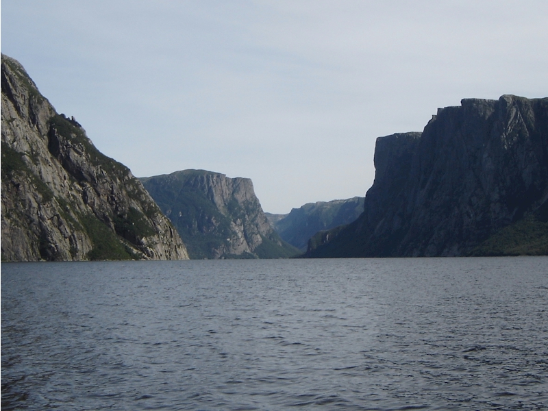
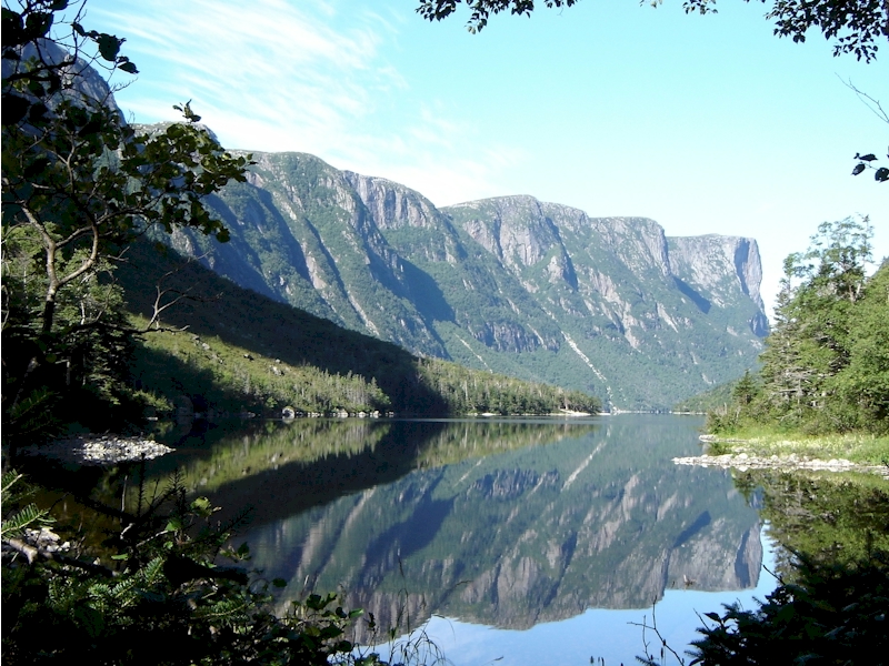
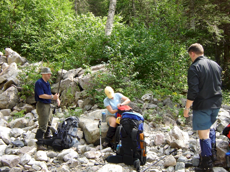
While waiting for the boat to launch we met another couple who were also starting the Long Range Traverse with us. We joined them and about 25 other tourists who were along to see the beautiful landscape in the Western Brook Pond “fjord”. The trip to the far end of the pond, the drop point for hikers, takes about an hour. We got off the boat at approximately 1100 hrs, and then made the quick hike to the primitive campsite where we stopped to adjust our rucks and slap on some bug spray. Last year we had found out the hard way that there were still swarms of black flies in the gorge, even in September.
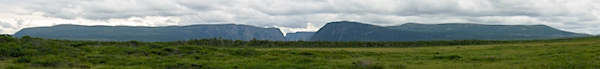
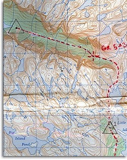
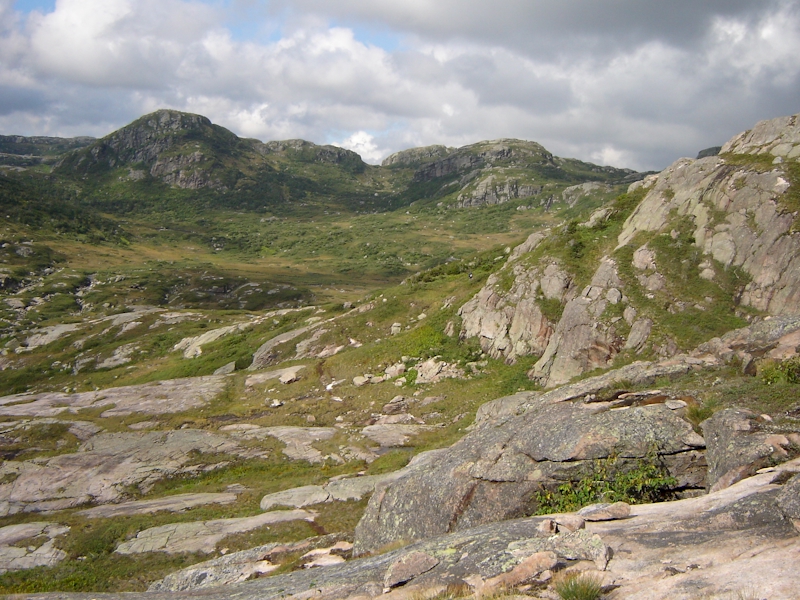
Once we were all sorted out we began the hike into the gorge. The trail was damp, but not heavily muddied at this point, so we made very good time early on. We had made it through the large crater shaped meadow (grid 529066) within 30 minutes of setting out, and we had very few difficulties finding the “trail”.
There is no marked trail per-se on the Long Range Traverse, but there are numerous game trails and hunting paths throughout the journey. These can be both a blessing and a curse at times. For portions of the “recommended” route where there is visible trail, it can make for quicker travel and can help in the avoidance of difficult features and terrain such as tukamore patches (thick tangles of dwarf spruce and fir). Unfortunately, since many of the paths are made by wild game, they can lead you far off the recommended route of travel. As you might expect, the wildlife don’t really care how to get to the next campsite, so relying too heavily on their trails can lead to problems.
The best rule of thumb is to use trails when they agree with the general direction of travel your compass and GPS are telling you to follow, but not to hesitate to leave a trail if it appears to be diverging from your desired route of travel. Depending on the time of year you hike, you may see many human footprints on the trails. It is extremely difficult to resist the urge to follow the footprints of your predecessors, but you have to trust your compass and go where it tells you to. There were numerous places where there were well worn paths leading in the wrong direction. In some ways, those folks doing the hike early in the season are probably better off.
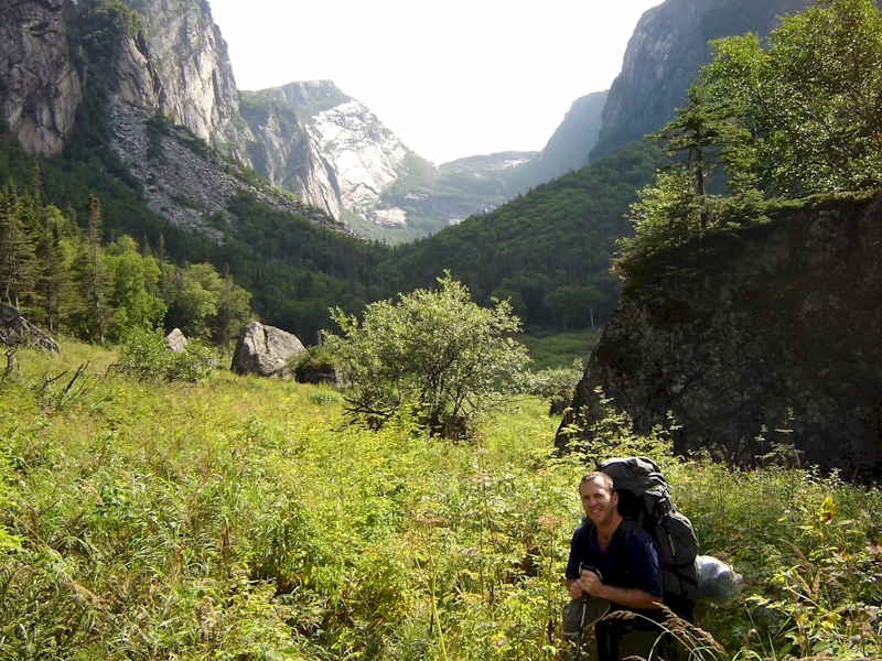
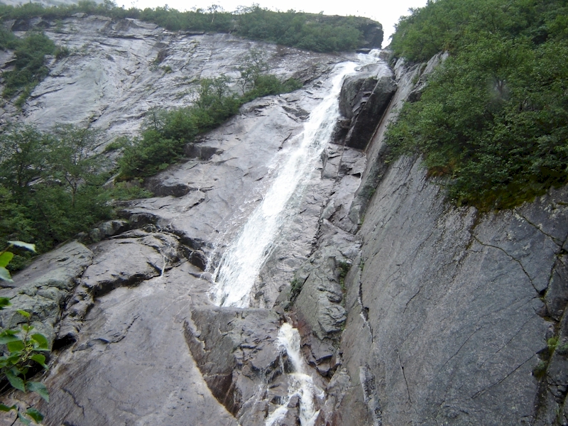
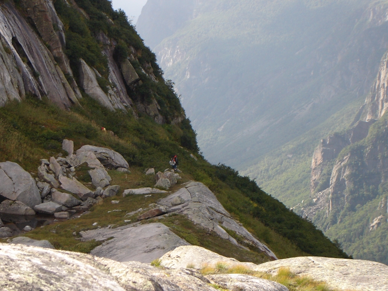
We worked our way through the gorge at a good pace and were quick to perspire due to the heat and humidity. We ran into a few spots where we had to work around clusters of house sized boulders, but for the most part it was smooth sailing. Our experience from the previous year made the initial part of the trek pretty straight forward. We stopped for water and food at a rock slide that that had served the same function the previous year. The other couple who had gotten off the boat with us, pushed on ahead on their own at this point. After a quick recharging of the batteries we were off again, and before long we began the ascent that makes this part of the trip the most challenging. We reached the base of a tall waterfall at the eastern end of the gorge and begin to climb and scramble up to the right of the falls. The going is slow here, and there are spots where the scrambling can be very challenging, especially for the shorter members of the group. It is also always somewhat tricky to scramble with 45 lb packs on as you have to be very conscious of your distorted centre of mass.
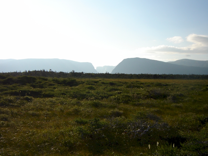
It was during this section of the ascent that we made our wrong turn the previous year. Because of this we were paying very close attention, looking for a spot to cross over the stream that we were climbing parallel to, in order to break out into the upper portion of the gorge. Even knowing that this might be an issue, we still almost missed the turn. It was marked by a previous hiker with two fist sized white stones that could very easily be missed. Even once we made the turn there was a steep and slippery climb up a 15° angled slab of rock that made us think we might have gone the wrong way. Fortunately, it soon became apparent that we were on the right track and we popped out into the clearing that is seen in most of the brochures and postcards for Gros Morne National Park. The view was fantastic, and the feeling of relief was palpable, but it soon became apparent that there was still lots of work ahead before the day would be done.
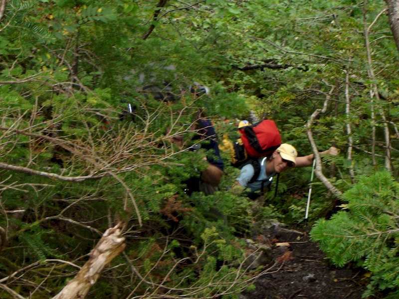
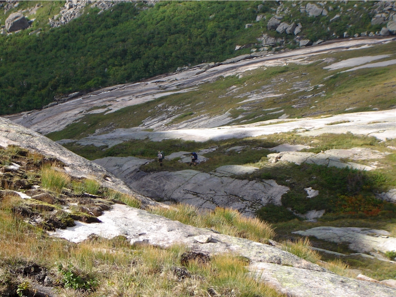
Before we pushed on up we noticed the trees moving across the valley. We knew right away that the couple that had gone on ahead of us had taken the same wrong turn we had the previous year. By the time they got to the dead end that marked the end of that path, they were close to 500m away from us across a steep valley. We tried to shout directions to them, but they were too far away to actually hear us. They eventually figured it out and bashed their way back down, before finding the correct path and heading up behind us.
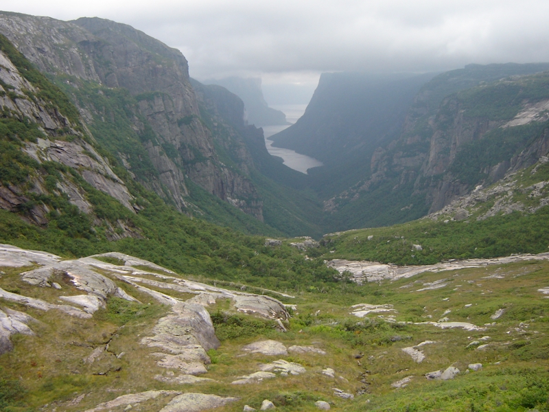
From this point the hike was steep but steady up large flat slabs of rock and across patches of soft vegetation. Once we got near the very top we had to veer south to begin the trek to the first camp site. Unfortunately, the gorge had one last test for us. On the map this area looks deceptively simple in comparison with the steep climb we had just undertaken, but there is actually a significant rock wall that has to be scaled before you can get out of the gorge. We looked around for an easy, safe route up, before eventually trying three different spots, each with their own challenges. One involved climbing up a rounded rock with little to hold onto and a 20’ fall waiting for you if your lost your footing. One of us went up this way before we moved onto another spot which had a less dangerous drop associated with it, but required more technical skill to climb. Our final two group members moved 200-300 m East and found a safer way to the top.
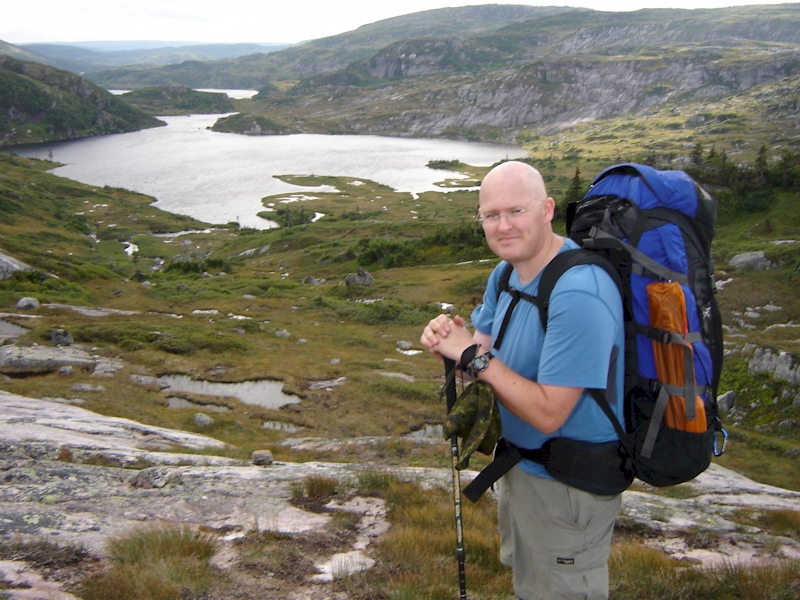
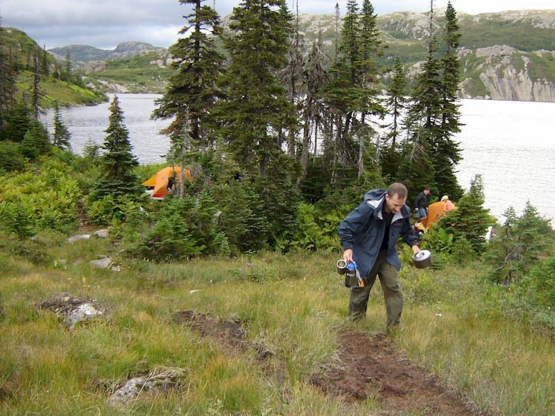
Further complicating matters as we finished our time in the gorge, was the arrival of rain showers and extremely strong winds. The wind speed was almost enough to knock you off your feet, and this was a little bit unnerving due to the fact that you were scrambling over rocks at the time. This wind phenomenon is mentioned in the literature provided by the National Park and subsided once we moved on towards the Little Island Pond camp site. The campsite was still another two kilometers away and although it was relatively easy to find, it did still take a while to come into view as the exertions of the day coupled with an often very muddy path made for slow going.
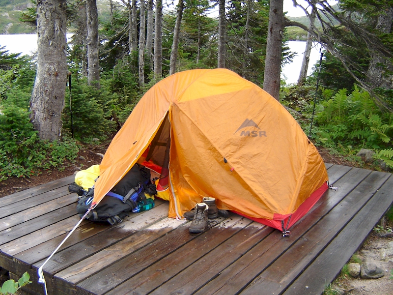
We reached camp at about 1800 hours and the other couple arrived just a few minutes behind us. We quickly pitched our tents and stowed our equipment before making supper for the evening. The primitive campsite included three 10’ x 10’ pallets/tent pads and also had a bear box to stow food in. We didn’t take long to get into the tents and settle down for the night as it has been a full day. Despite the fact that we were all tired, our morale was high after having completed perhaps the most challenging portion of the Long Range Traverse.