Tuesday, 6 September 2005
We woke up on Tuesday morning to another beautiful day and an almost cloudless sky. The temperature was still cool, but had warmed up since the previous evening. We went out onto a large flat rock in the small lake by the campsite to brew-up and catch some sun at breakfast. We then spent some time trying to figure out the best location to cross the second significant water crossing of the trip which was right next to the campsite. The crossing here was wider (15 m), and deeper, so we were quite concerned that someone might slip on the wet and loose rocks. We packed up and made the plunge, with the water coming close to the top of the thighs at times during the crossing. We all made it without any major difficulties and we were on our way.
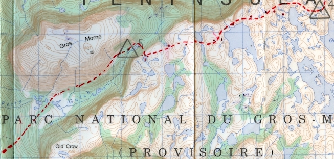
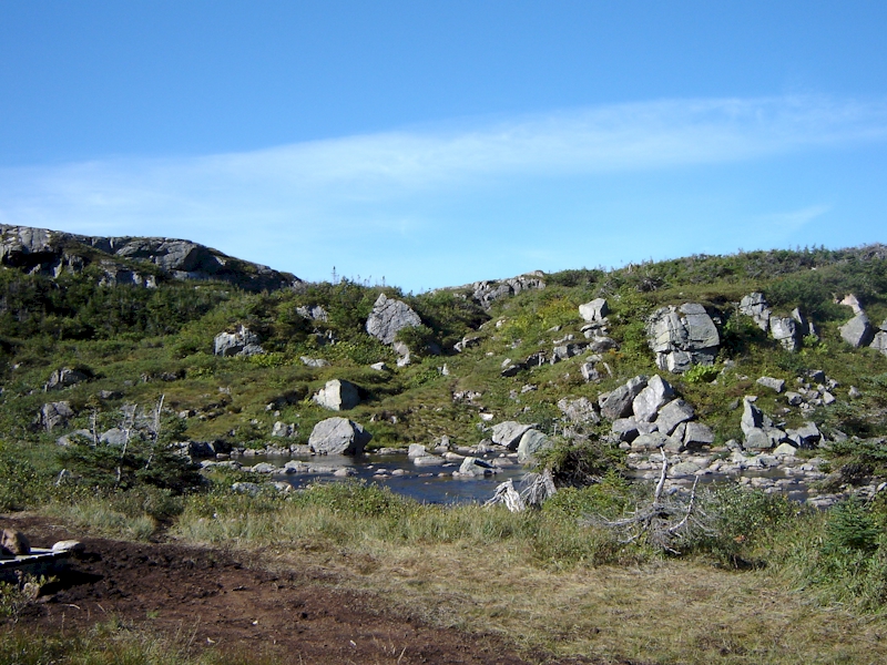
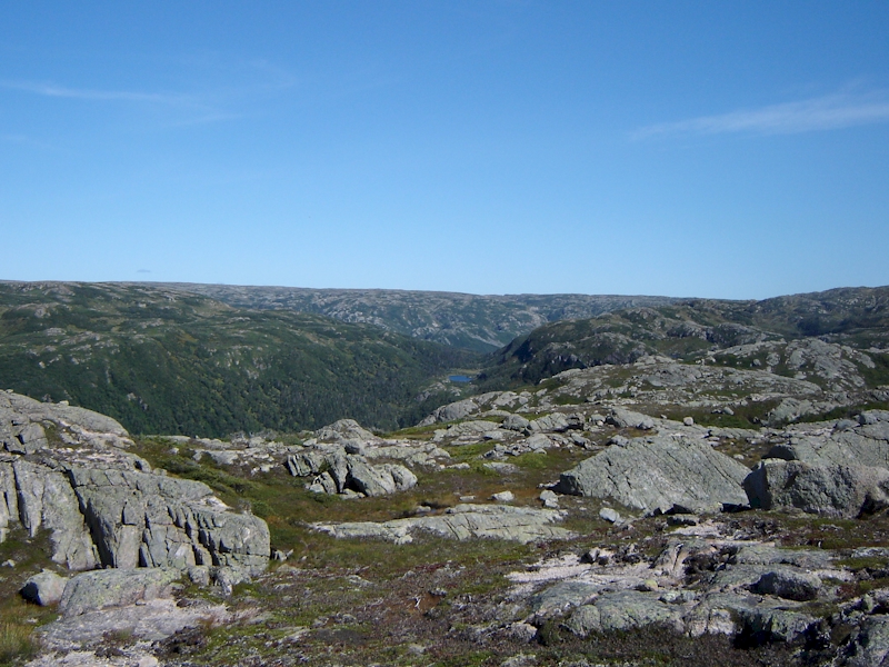
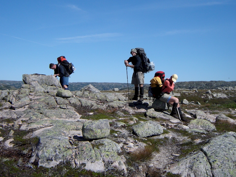
The terrain coming out of camp consisted of a series of climbs and descents up and down some steep terrain features. Despite the constant up and down and the endless parade of small lakes that could easily lead to confusion, we found that we had very good luck sticking to the recommended route of travel throughout the day. We had learned from some of our experiences the previous day, and we made a more conscious effort to have multiple team members using their maps and tracking our progress. That being said, we still relied on our GPS to verify our map grids. We stopped for water and food next to a large lake at grid 466941 and were quite pleased with the progress we had made to that point in the day.
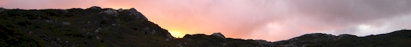
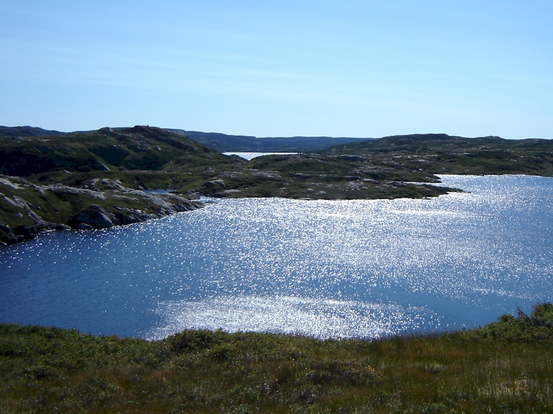
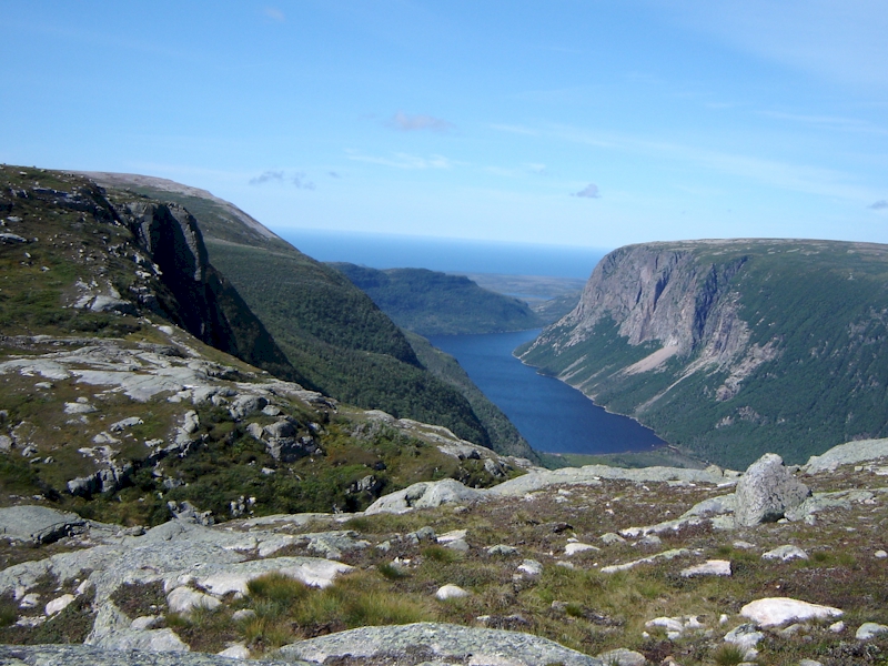
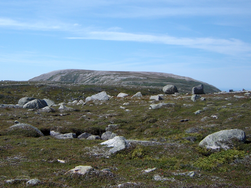
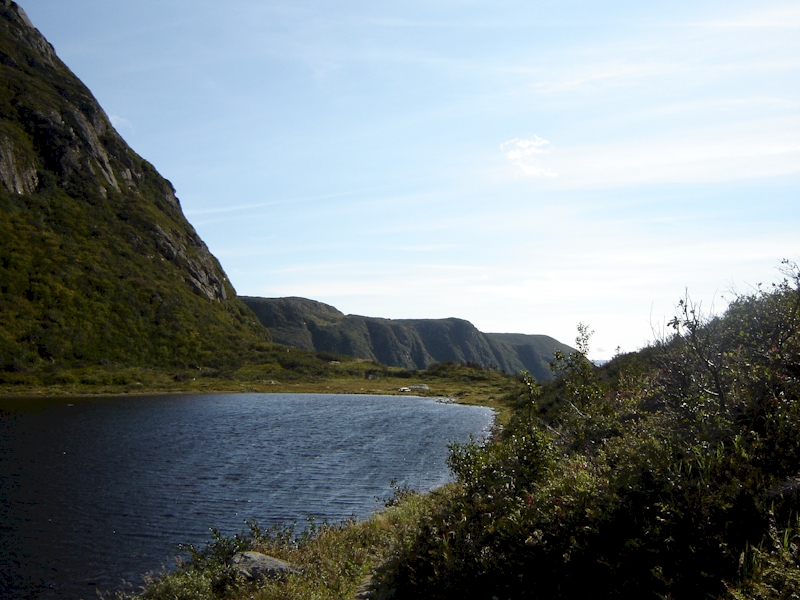
Throughout the final day we caught glimpses of Gros Morne Mountain in the distance to the West and it certainly helped boost morale and energy in the group. The overall scenery was breathtaking at times. You could see the rugged rolling plateau towards the North and East where we had come from and the amazing view provided in Ten Mile Gorge just slightly North of our direction of travel. Eventually we got to a point where we had a clear view down Ten Mile Gorge and it was a moment that really added to the overall experience of hiking the Long Range Traverse.
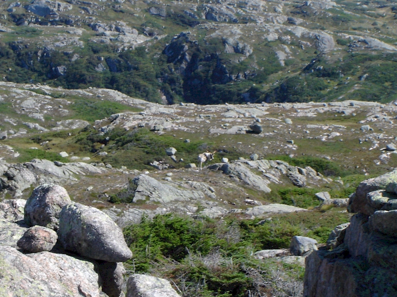
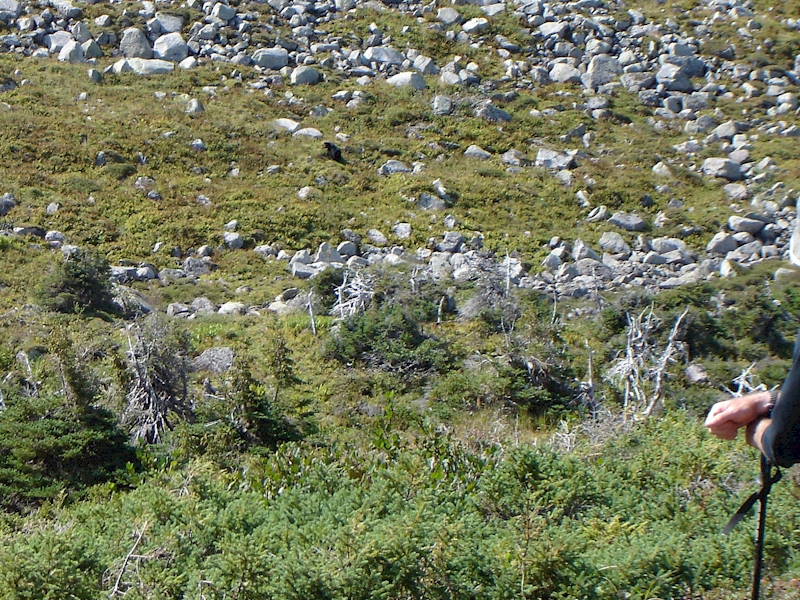
We were continuing to make good time, and had just come over another considerable high feature, when we heard the word we were hoping to avoid on the trip�Bear. One of our party had spotted a large black bear rooting through a berry patch about 300 m away, directly on our intended path of travel. We all quickly froze and eventually moved to our left and hunkered down around a large boulder to wait him out. Unfortunately, he was just on the other side of a land bridge between two lakes at grid 460937. Due to the nature of the terrain in this area, it would have been difficult and time consuming to try to find another way around. We decided to wait him out. As we sat there, our body temperatures began to drop and the wind started to cut through us. We slowly began adding layers, and the bear was taking his sweet time moving along. Eventually the other couple came up behind us and joined us.
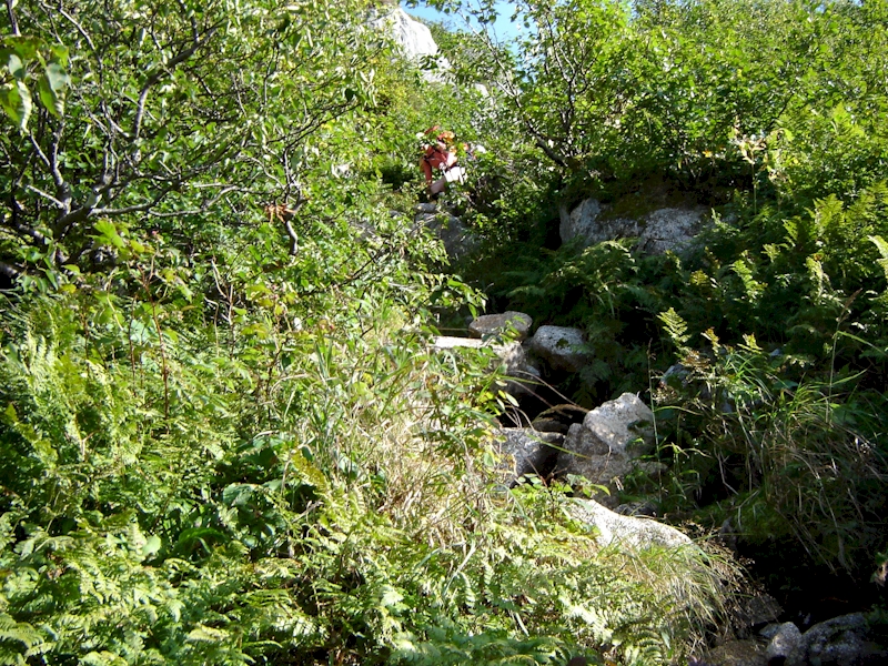
After an hour and forty five minutes he had wandered far enough South that we felt we could safely resume. Once we hit the far side of the valley we flew up the far side in an effort to put as much distance as possible between us and the bear. Luckily we never saw him, or any of his kind, for the remainder of our journey. From this point on we had less than two kilometers of hiking before the descent into the Ferry Gulch campsite. We quickly covered this distance and then were faced with the steep descent off the ridge. After finding the right location we began the climb down. We were dropping about 200 m of elevation in just 100 m. The trail seemed to follow a small stream bed down. Although it was slow going at a sharp rate of descent, there were plenty of shrubs and roots to hold onto to help slow your momentum as you made your way down. It probably took about 30 minutes to get down at which time we linked up with the more established Gros Morne Mountain hiking trail.
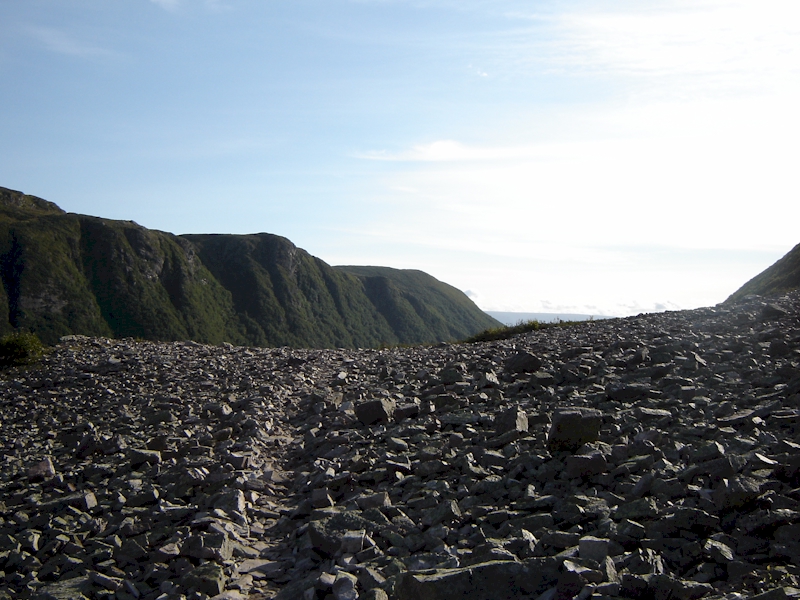
We had basically finished the Long Range Traverse at this point and we all shared a sense of relief and accomplishment. We pulled into the camp site and took a quick water and food break before making the hike out to the parking lot. It was approximately 1630 hours at this point. The trail out was well marked, but was anything but a cakewalk. There were many spots where the trail crossed large rock slides full of loose shale that played havoc with the shins and ankles. We also spent the next few hours going down which, as most hikers know, is the time you can put a lot of stress on your ankles, shins and knees with the extra 45 ponds of the rucksack coming down with every step. Although it seemed to take forever, we finally hit the parking lot at about 1930 hour. It felt very nice taking off the packs after about nine hours of hiking/bear watching.
In four days our journey had come to an end. After having had to turn back the year before, we were left with a sense of pride and accomplishment. We had just completed a tough trek through some rugged, and occasionally challenging, terrain with none of us being any worse for wear. Overall, the Long Range Traverse proved to be a rewarding experience that provided a nice balance between exercise, adventure and time in the great outdoors. For those people with the right level of hiking, camping and navigation experience, we highly recommend this adventure. We also know that it is likely to draw us back again at some point!