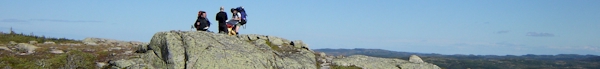
Monday, 5 September 2005
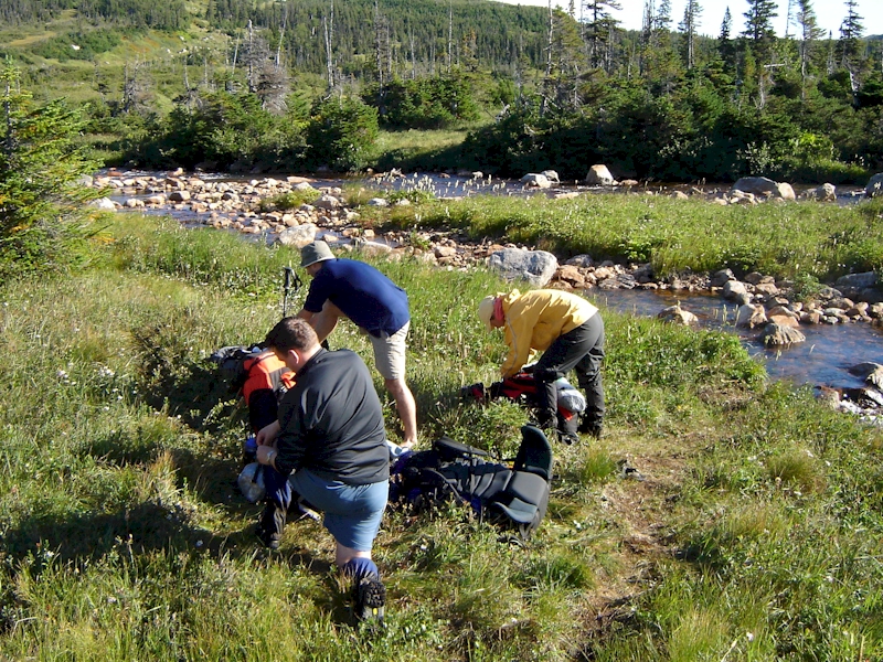
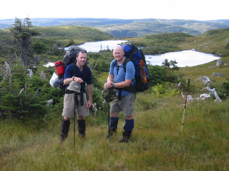
We awoke on Labour Day Monday to the sun in the sky and a cool but comfortable temperature. After having a quick breakfast we packed our rucks and prepared for a long day. We were planning on doing a “double”, or trying to travel the distance between the next two campsites. Almost immediately after leaving the campsite at Marks’s Pond we hit the first of two significant water crossings on the Long Range Traverse. The river in question was only about 10 m across and knee deep, but it was moving rapidly over loose rocks so it was still an obstacle that required respect and patience to successfully negotiate. We each put on a pair of sandals and slung our boots before crossing. We also all used a hiking pole for stability and the crossing proved to be fairly straight forward in the end.
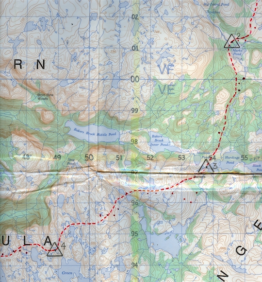
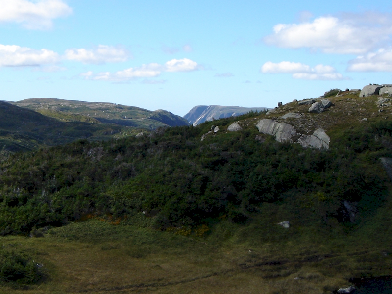
We threw our hiking boots back on and began the hike to the next campsite at Harding’s Pond. About a kilometer into our travels we reached our first major decision point of the day (approx grid 549000). We were again following a well beaten trail out of the camp and it was heading in a southeasterly direction after skirting the edge of Mark’s Pond. Despite the well worn nature of the path, we began to sense that we were not going to make it where we were heading if we stayed on it. We confirmed our grid with the GPS, and sure enough, the bearing the path was leading us was well-off our desired direction of travel. We fought the urge to stick to the well worn path and beat our own way up in the direction of a steep incline our compass was pointing us to. About 30 minutes later we were rewarded with the sight of some easily recognizable features which let us know we were on the right path. If we had stuck with the “beaten” path we would have added several kilometers, and several hours, to our trip. Once we crested the hill (approx grid 547996) and passed through the saddle ensuring the ponds remained on our left, we again picked up a well worn trail and had a fairly easy, if occasionally sloppy descent into the campsite at Harding’s Pond.
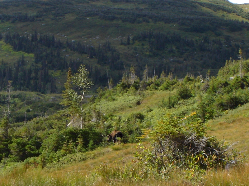
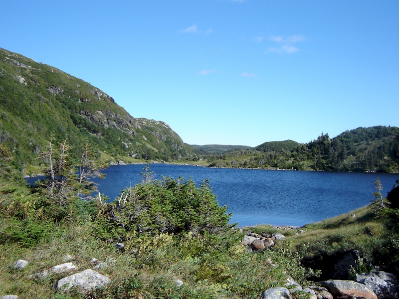
About 100 m prior to arriving at the campsite at Harding’s Pond we ran into a large bull moose that was almost lying on the trail. The terrain features at this point made for a fairly narrow crossing point, so he could not be easily avoided by circumnavigation. We decided to stop and brew up lunch while we waited him out. After 30 minutes lunch was done, but our new friend was still within 12 m of the path. The other couple had caught up to us by this point, and after some discussion we decided to try to walk past him. We sent two “guinea pigs” out first, and once they passed with no difficulty the rest followed. It was a little unnerving, but he paid very little interest in us as we passed. We stopped to re-fill our water bottles at Harding’s Pond and then began the trek to the next campsite. It's worthwhile noting both our water filters and a third from the other couple simultaniously clogged filtering water from Harding's Pond. Not sure why.
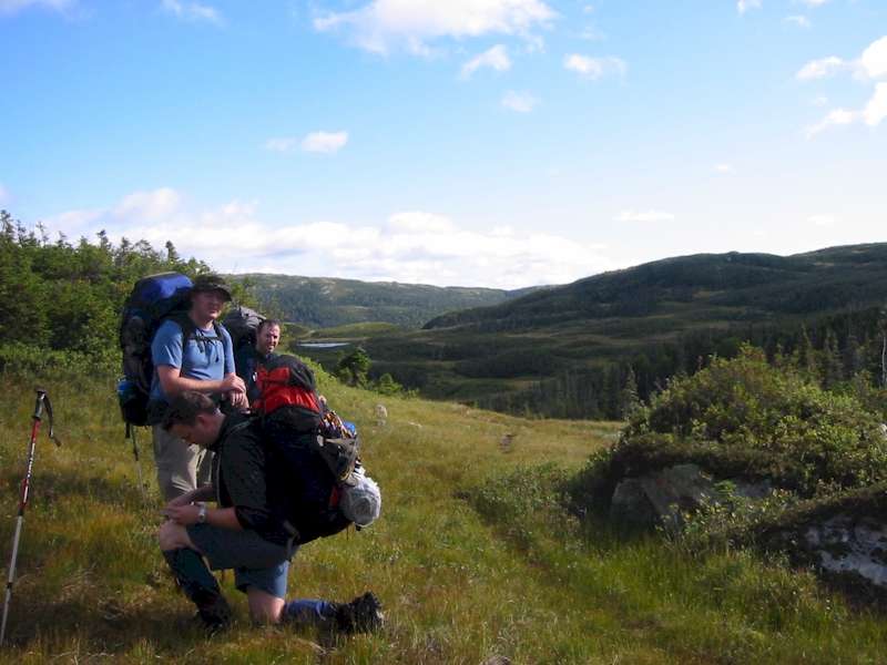
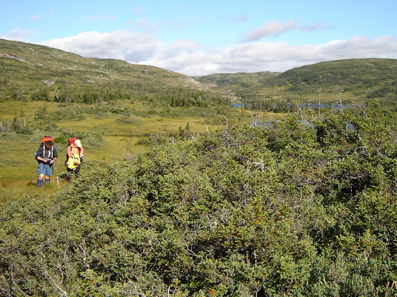
Unfortunately the smooth navigation we had experienced in the morning was not duplicated in the afternoon. We hiked about a kilometer out of camp before we realized that we were already off course by almost 300 m. Again we were following a well worn trail and we were facing a significant climb up a high feature. After debating the merits of bashing across the boggy terrain towards the “recommended route”, or carrying on up the well worn path, we decided to take the path, hoping it was leading to a switch-back or change in direction that would get us back on track. Now that our group had grown to six people, we seemed to loose the determination and focus we had as two smaller parties. The group mentality quickly set in, and with no named leader, we began several hours of hiking together and working our way back towards the “path”, but never truly pushing hard to rejoin it. This was, of course, made more difficult by the fact that there isn’t always a path to follow. Our efforts to rejoin the path may have been in vain in any case. Despite our less focused method of travel, we were still moving in the right direction and we all enjoyed getting to know each other a little bit better as we hiked.
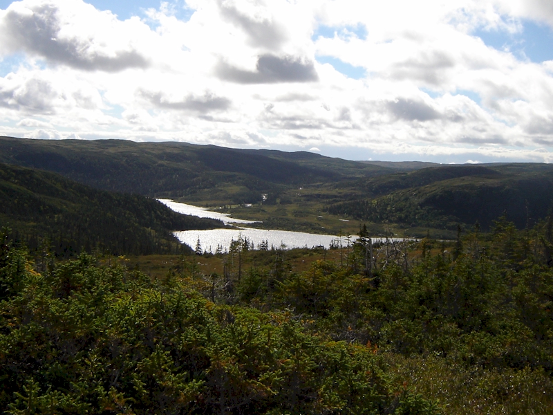
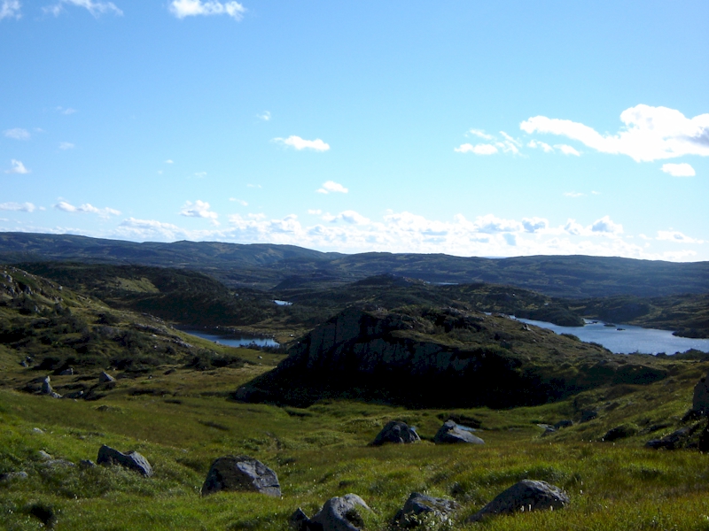
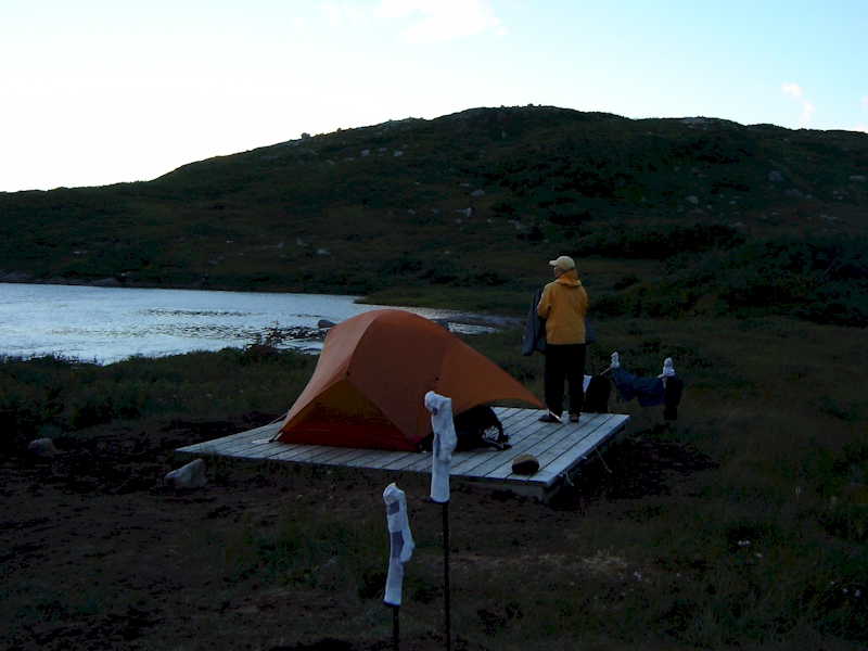
Eventually we rejoined the “trail” for the decent into the valley that contained two closely linked lakes at grid 512963. We stopped for water and assessed our situation. We were still about 2.5 km from our next campsite and it was approximately 1530 hours. We knew we still had enough time to make it to the next campsite before dark, but our margin for error was getting smaller. We split up again at this point with the other couple heading off ahead of us. We were beginning to feel the wear of over six hours of hiking, but once we got moving again the momentum picked up. From this point on we focused on our map and compass a little bit more, and had better results. Our renewed navigation focus successfully lead us to the campsite for the night around 1830 hours.
The site was set in a closed in and deep valley near a small lake just North of Green Island Pond. The ground in the area was pretty wet, but we were happy to have three of the wooden pallet/tent pads in this location. We again set up and tried to dry some of our clothing and equipment, but the temperature was significantly colder than it had been the previous day, with a biting wind to go along with it. We inhaled our supper and then crawled into our tents to get out of the cold. During the night we found that we had a lot of condensation building up inside the tents, and despite having bivi bags, some of our sleeping gear still got wet. Luckily, we were planning on doing another “double” on day 4, so we were hoping we wouldn’t have to face a night in a damp sleeping bag.